Page Feedback

Museum of Mountain Flying
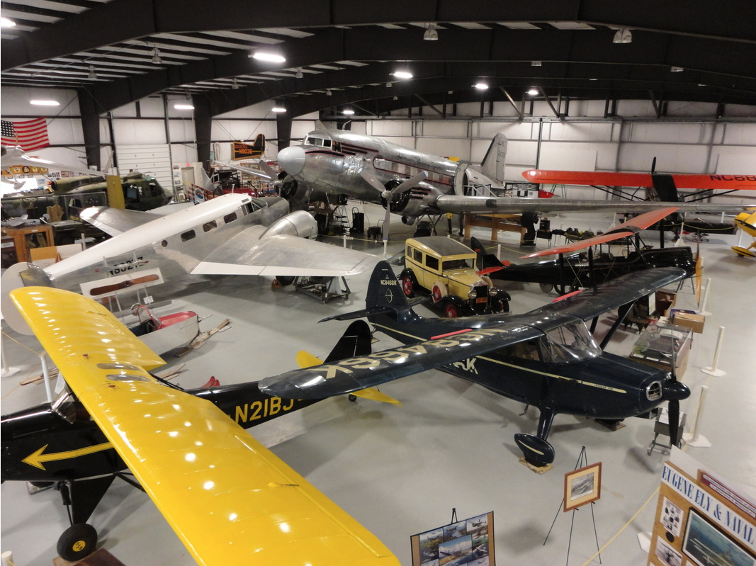
Museum of Mountain Flying

Information

10AM-4PM
Museum 406-721-3644, Office 406-825-5080, Tours 406-552-5413
lat: 46.9175351 long: -114.0780965

The Museum of Mountain Flying traces its roots back to 1993 when it was a three-acre “boneyard” of Johnson Flying Service. Stan Cohen, Dick Komberec, and Steve Smith decided to turn this land into a museum to honor and preserve the history of the premier mountain flying service in the Northern Rockies area, from the late 1920s to the early 1970s. As time passed, the museum continued to grow but couldn’t withhold all the artifacts that were being gathered. That is, until Rick Nash stepped in.

Rick Rash is a local aviation enthusiast and was about to build an 18,500 square foot hanger to support the rest of the artifacts. Today, The Museum of Mountain Flying is to maintain historical Northern Rockies aviation for future generations by preserving aircraft, memorabilia, artifacts, historical documents, photographs, personal narrative/diaries, motion-pictures, tape recordings, newspaper stories, magazine articles, and books. Visitors come from all over the world to get a gaze at the historical Northern Rockies aviation technology. If you find yourself in the area, come see us!

Nearby Attractions

Distance Unit:

Nearby Trails

Distance Unit:

Judith Landing to Woodhawk Wilderness

lat: 47.7400888 long: -109.6276312
Lolo Trail to Nee Me Poo Trail #40

lat: 46.58654 long: -114.73281
Blackfoot River

The Blackfoot River, sometimes called the Big Blackfoot River to distinguish it from the Little Blackfoot River, is a snow-fed and spring-fed river in western Montana.

lat: 46.9177068 long: -113.6781495
Clearwater to Dunnigan Gulch


lat: 46.9505625 long: -113.5433125
Missouri River Left

lat: 46.6822743 long: -111.8215701
Coal Banks Landing to Eagle Creek

lat: 47.7400888 long: -109.6276312
St Lawrence Creek Fishing Access

lat: 45.7109992 long: -111.0506995
Tower Rock Trail

lat: 47.188617 long: -111.8101938
Coal Banks Landing to Eagle Creek

lat: 48.0338635 long: -110.2279854
Beaver Creek to Hauser Lake

lat: 46.6822743 long: -111.8215701
Old Buffalo Trail 3

lat: 46.9547545 long: -113.5255417
Missouri River to Hauser Dam

lat: 46.7649385 long: -111.8858237
Send Feedback

Instagram Feed