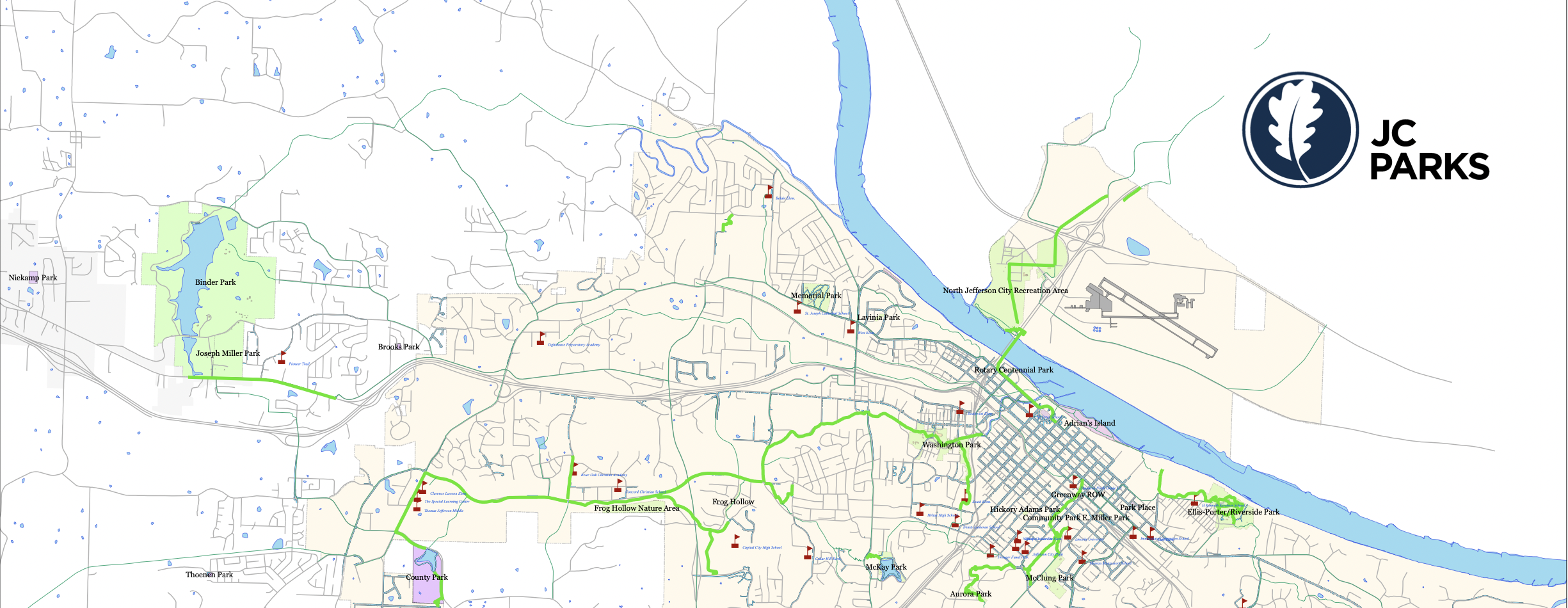
Page Feedback

The Skywalk Trail

The Skywalk Trail

Information

573-632-2820
Free Admission
Service animals are welcome; Pets on leash allowed
lat: 38.5875644 long: -92.1788707

Loved by hiking enthusiasts, the Skywalk Trail in Jefferson City will connect you to the Missouri River Pedestrian/Bike Bridge, as well as other surrounding parks and trails around the city. It is part of an ongoing campaign of the city to connect all pillars of the community to one another while practically providing safe and alternative methods away from the busy streets. Whether it’s walking, running, jogging, skating, or biking, visitors will have 15 miles ahead of them to explore different parts of Jefferson City.

This route allows easy access between the Noren river access park, the Katy Trail, and downtown. On the Jefferson City side, the entrance to the bridge is at the intersection of West Main Street and Clay Street.

Nearby Attractions

Distance Unit:

Nearby Trails

Distance Unit:

Trail of Tears Nature Trail

 Here, nine Cherokee Indian groups braved harsh winter conditions while crossing the Mississippi River in 1838-1839, marking a sorrowful chapter in American history. The park also has: shaded picnic sites, hiking and horse trails, opportunities to fish…

lat: 37.4388916 long: -89.480974
The Gateway Arch

lat: 38.6254157 long: -90.1881888
New Haven Public Access

lat: 38.61434 long: -91.21069
Klondike Park River Access

lat: 38.5840552 long: -90.8200764
Taylors Landing

A boat ramp to the beautiful Missouri River with a peaceful view of the river.

lat: 38.94831 long: -92.53559
Red House Path

lat: 37.3008461 long: -89.5186713
LaBenite Park to Miami

lat: 39.16744 long: -94.39343
Klondike to Mississippi River

lat: 38.58395 long: -90.81858
Trail of Tears Memorial

Explore the Trail of Tears State Park to delve into a somber chapter in American history. Here, nine Cherokee Indian groups crossed the harsh winter Mississippi River in 1838-1839 during their forced relocation to Oklahoma.…

lat: 37.4439902 long: -89.468381
Red Star Access Site

lat: 37.3156208 long: -89.5126263
Noren Access Path

lat: 38.5894 long: -92.17918
Jefferson Mounument

lat: 38.57877 long: -92.17348
Send Feedback

Instagram Feed