First there was the land, the mountains and the rivers. Humans are but recent newcomers to this place now called Montana. However, when and how they arrived is still a mystery. Pictograph Cave State Park is a place to contemplate the origins of human habitation of Montana. The pictographs are more than 2,100 years old. Their interpretations are still subject to great debate. Do they simply document hunts, or do they honor people or their scripts?
The images of animals, warriors and even rifles tell a story that has lasted thousands of years. The three main caves – Pictograph, Middle, and Ghost cave complex was home to generations of prehistoric hunters. They were carved from the Eagle sandstone cliff by the forces of water and wind erosion. The first major discovery of artifacts and paintings in the caves was made in 1936. Approximately 30,000 artifacts, ranging from stone tools, weapons, paintings and the instruments used, have been identified from the site.
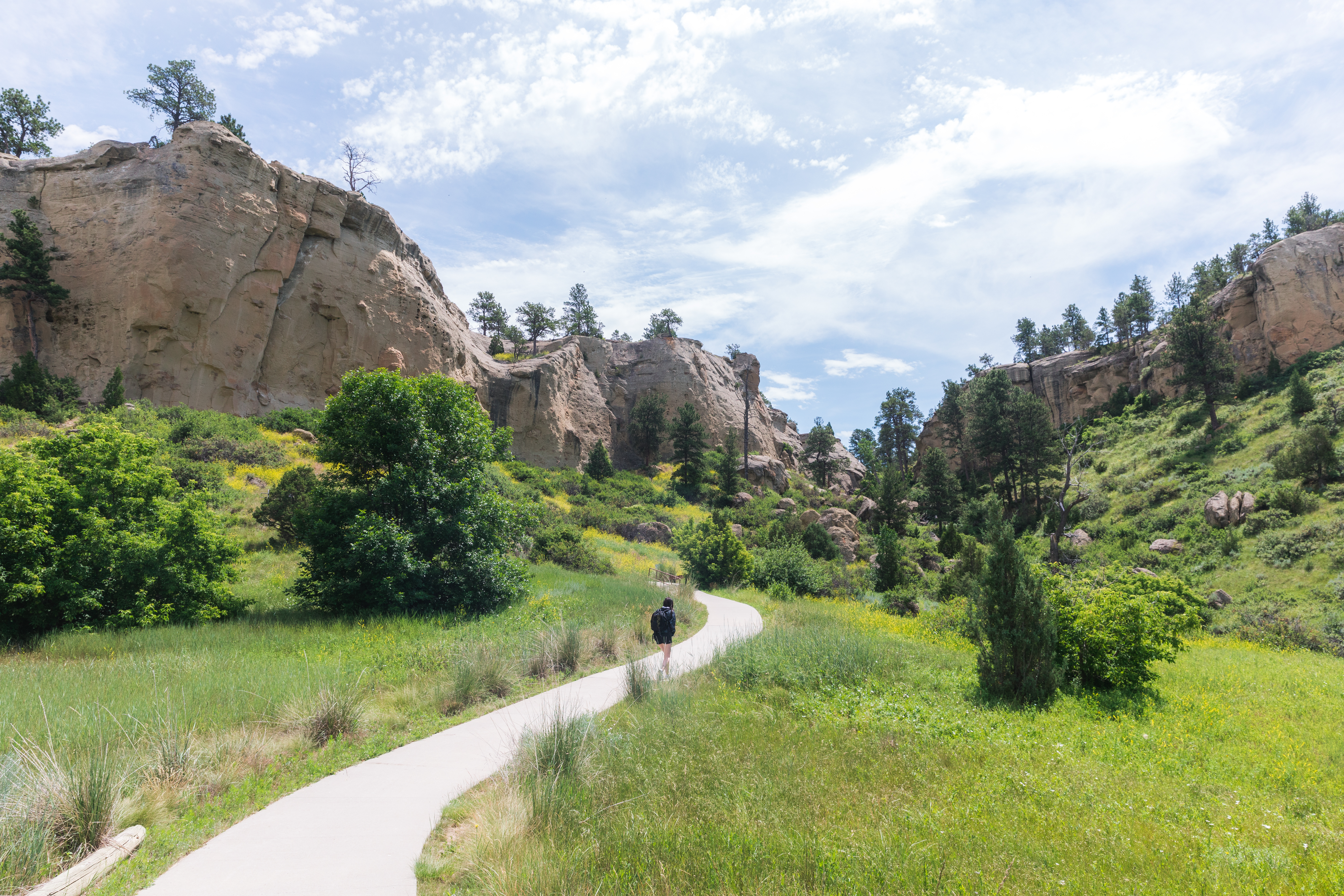
The red, black and white pigments used provide key information and evidence suggesting that the caves were first used by nomadic hunters seeking shelter. The artifacts discovered allow researchers to pinpoint which peoples used the caves and when they inhabited the region. The park has paved trails to the caves, with interpretative displays along the route identifying and explaining the natural features, the prehistoric paintings and vegetation found in the area.
The Pictograph Cave is the deepest of the three main caves, at approximately 160 feet wide and 45 feet deep. Visitors are advised to bring binoculars to get a better view of the rock art. Allow at least an hour to complete the pleasant .25 mile loop of the ancient rock paintings.
About Pictograph Caves State Park
- There are picnic facilities available for day use only, but no camping is permitted.
- It is a National Historic Landmark.
- The park is 23 acres in size and 3,500 feet in elevation.
- It offers vault toilets, grills/fire rings, picnic tables, trash cans, and drinking water.
- Bikes are not permitted on the trails, and the trails and cave are not disabled accessible (only the restroom, water fountain, and parking area.)
- Binoculars are very helpful in viewing the pictographs.
- For non-resident visitors, the day use fee is $5 per vehicle.