Page Feedback

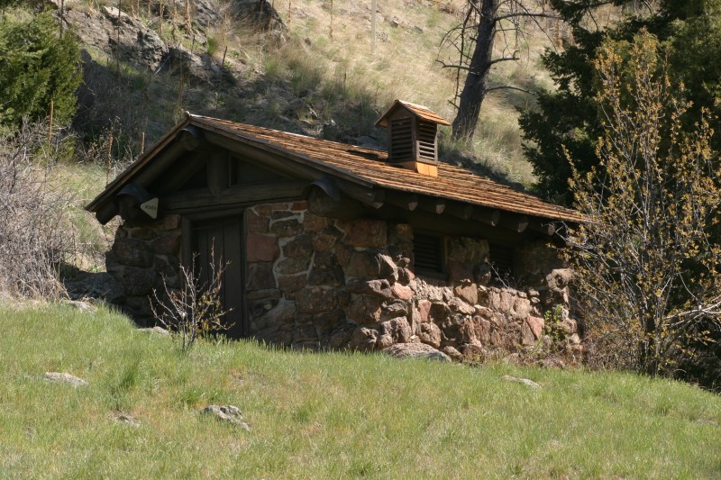
Civilian Conservation Corps Historic Development of Lewis & Clark Caverns State Park
Civilian Conservation Corps Historic Development of Lewis & Clark Caverns State Park

Information

9:00am - 5:00pm May- September; Hike In only thereafter
406.287.3541
Free to MT residents and registered campers; $6/vehicle entrance fee for non-residents
lat: 45.8341598 long: -111.8627751

During the late 1930s the Civilian Conservation Corps worked 5 years to develop Montana’s first state park, Lewis & Clark Caverns. Starting with the first ever building in the system (a rock latrine which still stands at the Upper Picnic Area), the CCC built the 3 mile road to include a Granite Keystone Bridge, the Cave Visitor Center, the trails to and from the cave as well as the basics for today’s caverns tours. An 538′ long exit tunnel was blasted in 1938 to make the tour a one-way route that would include the CCC-discoveredd, largest room they named Paradise.

This park CCC District is currently being nominated for the National Register of Historic Places.

Nearby Attractions

Distance Unit:

Nearby Trails

Distance Unit:

Lewis and Clark Pass

lat: 47.1427216 long: -112.4289137
Tower Rock Trail

lat: 47.188617 long: -111.8101938
Lolo Trail to Nee Me Poo Trail #40

lat: 46.58654 long: -114.73281
Morony Dam Trail

lat: 47.5816325 long: -111.0607994
Explorers at Portage

lat: 47.4925734 long: -111.3073279
Lewis and Clark Highway

lat: 44.97475 long: -113.44537
Eagle Creek to Hole in the Wall

lat: 47.8317525 long: -110.074063
Mcnamara to Bonner

lat: 46.9502198 long: -113.3787584
James Kipp Landing

lat: 47.6276519 long: -108.6854877
Missouri River Right

lat: 46.6822743 long: -111.8215701
Judith Landing to Woodhawk Wilderness

lat: 47.7400888 long: -109.6276312
Beaver Creek to Hauser Lake

lat: 46.6822743 long: -111.8215701
Send Feedback

Instagram Feed