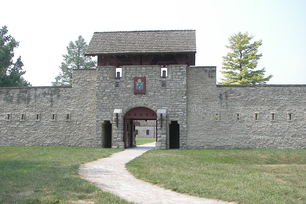
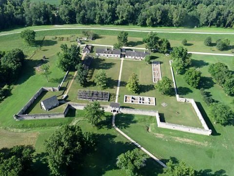
Fort de Chartres
France was a major player in American politics for many years, from the 17th century until Napoleon sold France’s territories in the Louisiana Purchase of 1803. Though France’s colonies were sparsely populated, the French influence can still be felt in Southern Illinois, with perhaps the best example being Fort de Chartres.
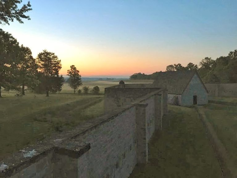
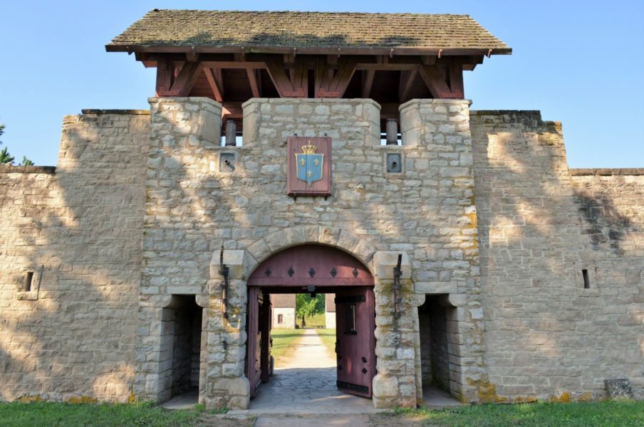
Originally a wooden fort, Fort de Chartres was upgraded to a stone fort from 1753 to 1754, right around the time when the French and Indian War began. While it was an important French fort, the Fort du Chartres was abandoned by the British and it fell into disrepair. Eventually, the only things remaining were foundations and the powder magazine.
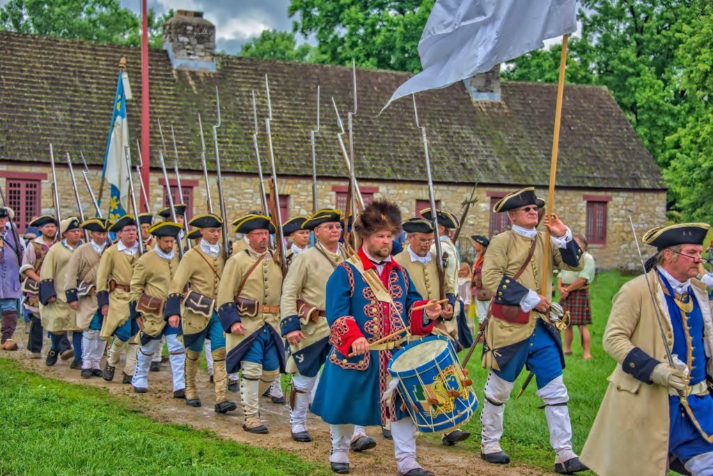
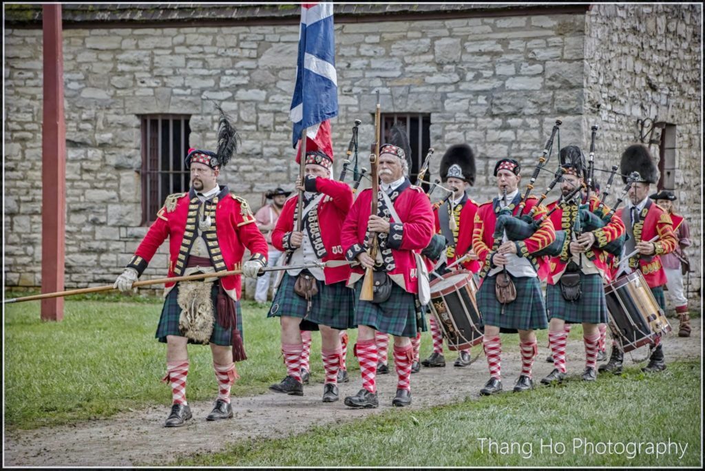
The Fort de Chartres, however, stands again, after many years of restoration. It is full of buildings and reenactors that make visitors feel like they’ve been transported back to the 18th century. Reenactors wear period clothing and give a great perspective on what life was like when the fort was built. Visitors will quickly notice the quality and authenticity of all of the restorations, as the fort has been steadily improved upon with painstaking detail since the 1920s. One would hardly know that they weren’t in France!
History lovers will be able to gather during the trade fair, where craftspeople sell reproductions of period crafts and people play historic games, as well as events like demonstrations of 18th-century cannons and a popular New Year’s Eve celebration. While there are always adventures to be had at Fort de Chartres, these event days have a special feeling of community amongst the visitors who all decide to travel back in time together.
Whether you are in the area during one of these special occasions or passing through on non-event days, be sure not to miss Fort de Chartres!
Distance Unit:
Distance Unit:


A boat ramp to the beautiful Missouri River with a peaceful view of the river.