Grizzly Sculpture in Great Falls
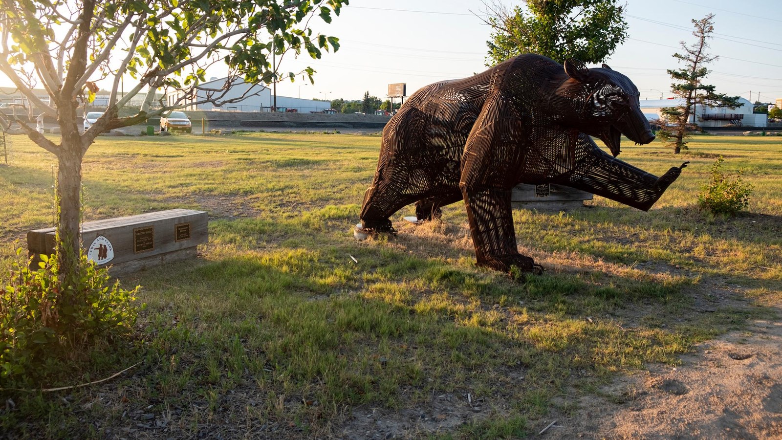
Along River’s Edge Trail in Great Falls, Montana you’ll come face to face with this life-size steel frame sculpture titled, “Grizzly Bear.” Created by Nathan Bread in 2008, the artwork commemorates the approximate location where Meriwether Lewis encountered a grizzly on June 14, 1805.
That day, Lewis was alone and came upon a herd of about 1,000 bison near a bend in the Missouri River. He proceeded to shoot a large, fat bull and was so distracted in admiring his kill that he forgot to reload his rifle and didn’t pay attention to his surroundings. Lewis ran at full speed for about 80 yards, then plunged into the river thinking that if he could go deep enough the bear would have to swim and he would defend himself with his espontoon. When he was waist-deep, he turned and saw the bear had wheeled about, ceasing his pursuit.
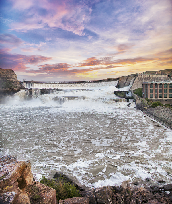
The River’s Edge Trail stretches for nearly 60 miles along both sides of the Missouri River and provides the perfect way to walk, hike, jog, skate, or cycle. The paved and single-track trails encompass spectacular views of the mountains, prairies, river canyons, waterfalls, and five hydroelectric dams while connecting to Great Falls’ historic downtown, city parks, entertainment venues, and local attractions.
Distance Unit:
Distance Unit: