Page Feedback

Hickory Canyons Natural Area
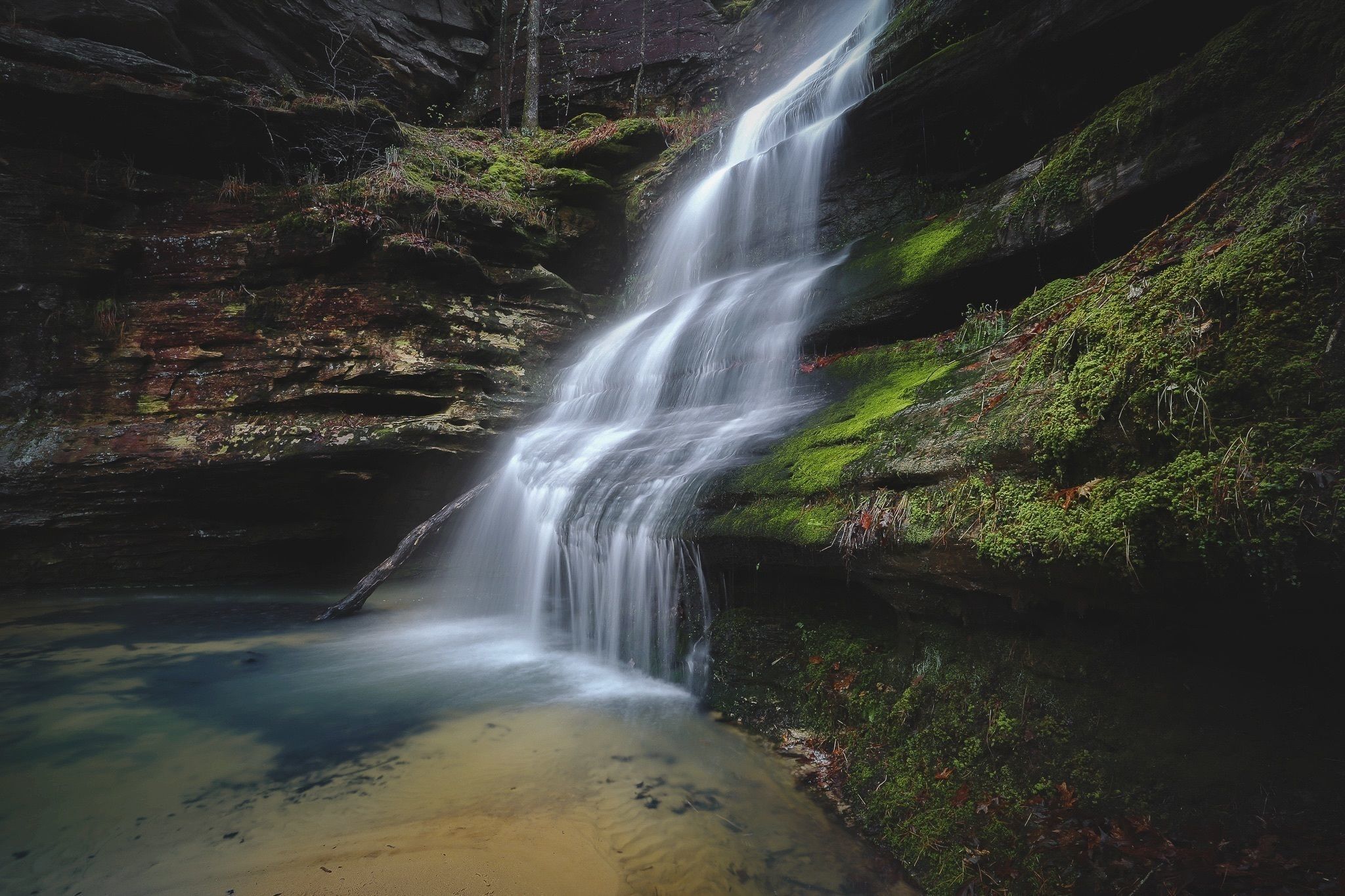
Hickory Canyons Natural Area

Information

4:00 AM - 10:00 PM daily
(573) 883-7097 or (573) 290-5730
free
Dogs must be leashed.
lat: 37.8724648 long: -90.3023083

Two trails in Hickory Canyons Natural Area offer interesting views of the area’s distinctive bluffs and canyons. In Hickory Canyons a number of unique plant communities grow, especially on the cool, moist cliff faces. Look for partridge berry, various ferns liverwort, and club mosses. In the bottoms grow rattlesnake plantain, spicebush, pawpaw, and deciduous holly.

In May you might smell the wild azaleas before you see them! Next to the parking area is a one-quarter mile trail leading to a steep-walled, horseshoe-shaped box can-yon. If there has been rain lately a 40 foot waterfall tumbles from one end.  Across the road is a hilly, rocky 1 mile loop that passes by steep sandstone bluffs, through the oak, maple, pine forest, & over a scenic creek. In the winter icicles may form on the rocks!

Directions: Take Highway 32 west from Ste. Genevieve or east from Farmington to Route C. Go north 3 miles and turn left on Sprott Road. Travel west 1.5 miles to the parking lot at 8388 Sprott Road.

Nearby Attractions

Distance Unit:

Nearby Trails

Distance Unit:

Trail of Tears Overlook

A breathtaking viewpoint overlooking the Trail of Tears State Park. Car access is available

lat: 37.4490937 long: -89.4764524
Chamoise to Klondike MO

lat: 38.70603 long: -91.73071
Trail of Tears Access

A boat ramp that allows visitors to access the Trail of Tears

lat: 37.4539977 long: -89.4625079
Trail of Tears to Cairo

The path taken by Chief John Ross on his way to Cairo. (https://www.hmdb.org/m.asp?m=161480)

lat: 37.45684 long: -89.46319
Noren Access Path

lat: 38.5894 long: -92.17918
The Gateway Arch

lat: 38.6254157 long: -90.1881888
Bean Lake Natural Area

lat: 39.49763 long: -95.02227
Lewis and Clark Nature Trail

lat: 38.77314 long: -90.4821
Klondike Park River Access

lat: 38.5840552 long: -90.8200764
Jefferson Mounument

lat: 38.57877 long: -92.17348
Francis Quadrangle

lat: 38.94607 long: -92.32836
Fort Osage Historic Park

lat: 39.1864762 long: -94.1928602
Send Feedback

Instagram Feed