Culbertson Mansion
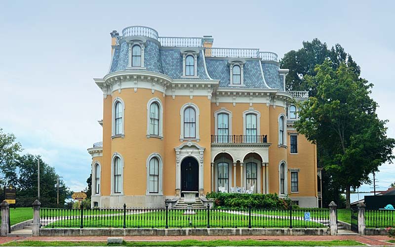
Located in New Albany, Indiana on 9 E. Main St. sits the Second Empire mansion, which is a style inspired by French Renaissance architecture, constructed for William Culbertson, an affluent, involved, businessman who later in life, became a renowned philanthropist. Built in 1869, this house represents an extravagant beginning to the Gilded Age in the United States, from the view of a man who was once considered the wealthiest man in Indiana.
This house shows the opulence of what one would see today in a 5-star hotel or even a well-kept castle in Europe. The house boasts 25 rooms, 3 stories and over 20,000 square feet. The building alone costs what would the equivalent of $2,000,000 in today’s economy. That is not even including interior decoration!
Inside, no expense was spared. Culbertson hired artists for each part of the room, from the ceiling works to the trompe l’oiel style walls for the first and second floors.
Despite its luxury, the grandeur of the house had diminished by 1964, and the property was in danger of being torn down and replaced by a gas station. However, a group called Historic New Albany saved the property, and shortly thereafter, the site was listed on the National Register of Historic Places and became a part of the Indiana State Museum and Historic Sites.
Distance Unit:
Distance Unit: