Page Feedback

Sluice Boxes State Park
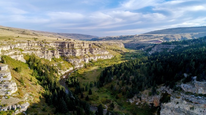
Sluice Boxes State Park

Information

Parking area/ trailhead open sunrise to sunset.
406-454-5840
Free for residents, $8 (per vehicle) for non-residents -- visit http://stateparks.mt.gov/fees/ for more information
lat: 47.2121598 long: -110.9357163

Soaring cliffs and precipitous ledges mark the Belt Creek Canyon as it slices out of the Little Belt Mountains and winds toward the town of Belt. Remains of mines, a railroad, and historic cabins line Belt Creek as it makes its way through the beautiful canyon carved in limestone. This rugged area has seen its share of prospectors searching for precious metals, miners, muleskinners, smeltermen, and railroaders building bridges. The Barker mines and the Montana Central Railroad are just a part of the rich history of Sluice Boxes State Park.

A primitive, unmaintained trail provides access to fishing, challenging floats, and wildlife viewing. Steep cliffs, rugged terrain, and cold, swift water may pose risks to visitors. Please use caution while hiking and floating in the park. Hikers, please note: the trestle at Tiger Creek is closed; through hiking is not possible.

A Backcountry Campsite Permit is required to camp in this park. Contact FWP headquarters in Great Falls to obtain a permit.

Nearby Attractions

Distance Unit:

Nearby Trails

Distance Unit:

Black Sandy Lake Access

lat: 46.7455285 long: -111.8866754
Clearwater to Dunnigan Gulch

lat: 46.9502198 long: -113.3787584
Missouri River to Hauser Dam

lat: 46.7649385 long: -111.8858237
Blue Mountain

lat: 46.8148437 long: -114.1806973
St Lawrence Creek Fishing Access

lat: 45.7109992 long: -111.0506995
Eagle Creek to Hole in the Wall

lat: 47.8317525 long: -110.074063
Decision Point

lat: 47.9249036 long: -110.4985534
Hauser Hiking Trail

A trail starting at Hauser Dam and overlooking the Missouri River.

lat: 46.765794328365 long: -111.88708305359
Beaver Creek to Hauser Lake

lat: 46.6822743 long: -111.8215701
Travelers Rest State Park

lat: 46.753308 long: -114.0899468
Clearwater to Dunnigan Gulch


lat: 46.9505625 long: -113.5433125
Lewis and Clark Highway

lat: 44.97475 long: -113.44537
Send Feedback

Instagram Feed