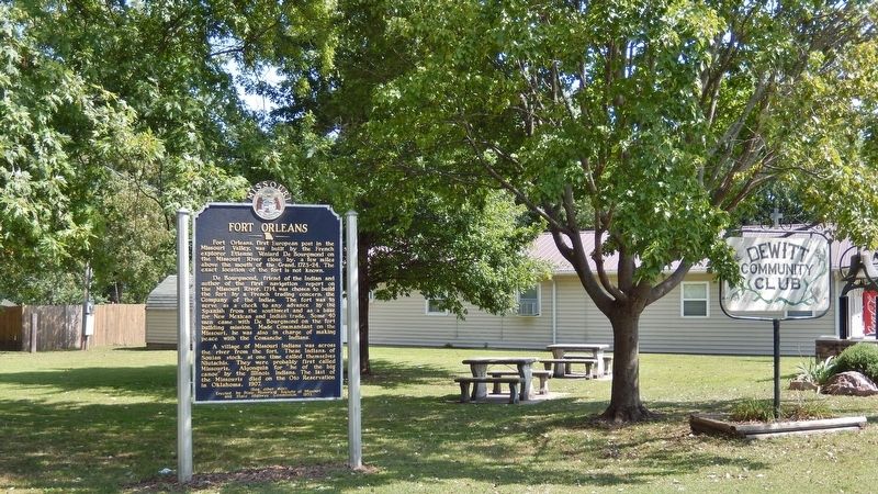
Fort Orleans Historical Marker
The first fort built by a European country on the Missouri River and the first settlement in Missouri, Fort Orleans is an important site for the state’s history. Although the exact site of the fort is unknown, a marker on US Highway 24 commemorates its importance to the region. The fort was initially used by the French as a site for trading with Native Americans, but was later abandoned in the late 1720s. The State Historical Society of Missouri and the Missouri State Highway Commission established this marker in 1953. While Lewis and Clark visited this area and were looking for the fort, they found no traces of a settlement, according to their journal entries.
Distance Unit:
Distance Unit:

A breathtaking viewpoint overlooking the Trail of Tears State Park. Car access is available


Here, nine Cherokee Indian groups braved harsh winter conditions while crossing the Mississippi River in 1838-1839, marking a sorrowful chapter in American history. The park also has: shaded picnic sites, hiking and horse trails, opportunities to fish…


The path taken by Chief John Ross on his way to Cairo. (https://www.hmdb.org/m.asp?m=161480)


Explore the Trail of Tears State Park to delve into a somber chapter in American history. Here, nine Cherokee Indian groups crossed the harsh winter Mississippi River in 1838-1839 during their forced relocation to Oklahoma.…
