Bicentennial Bridge
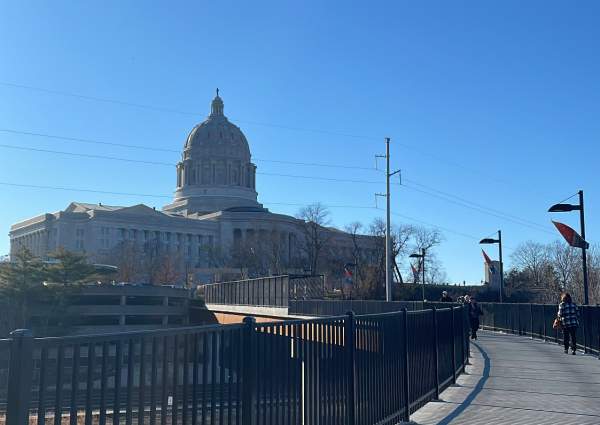
Connecting the Missouri State Capitol Complex to a 30-acre parkland, the Bicentennial Bridge links past to present for over 400,000 visitors annually. Featuring breathtaking views of the Capitol and the Missouri River Valley, this bridge is the perfect place to view Jefferson City’s landmarks. The bridge was first unveiled in 2021 to commemorate the 200th anniversary of Missouri’s statehood. Donors, including the DeLong family, are honored in educational panels along the length of the bridge. The bridge entrance includes a Gold Star Memorial that honors veterans and their families. Crossing over railroad tracks and connecting the capital to the park at Adrian’s Island, the Bicentennial Bridge stands as a testament to the state’s history and the dedication of the city’s people.


Distance Unit:
Distance Unit:

The path taken by Chief John Ross on his way to Cairo. (https://www.hmdb.org/m.asp?m=161480)


A breathtaking viewpoint overlooking the Trail of Tears State Park. Car access is available

Here, nine Cherokee Indian groups braved harsh winter conditions while crossing the Mississippi River in 1838-1839, marking a sorrowful chapter in American history. The park also has: shaded picnic sites, hiking and horse trails, opportunities to fish…


A boat ramp that allows visitors to access the Trail of Tears


Explore the Trail of Tears State Park to delve into a somber chapter in American history. Here, nine Cherokee Indian groups crossed the harsh winter Mississippi River in 1838-1839 during their forced relocation to Oklahoma.…

