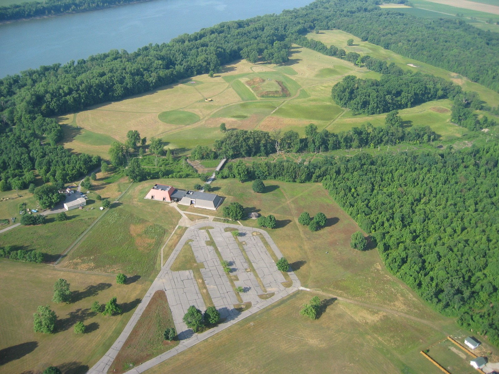
Angel Mounds State Historic Site is a Mississippian cultural site located along the Ohio River in Southwest Indiana. The site was home to a group of people from approximately 1000 to 1450. During this time, the residents constructed 11 earthen structures, truncated pyramids, for both status and ceremonial purposes. The largest structure, Mound A, is over 600 ft. long, 400 ft. wide and close to 40 ft. at its peak. The mounds at Angel Site were designed to elevate the elite of the community, with one being designated for ceremonial purposes. A combination of climate change, depletion of resources and possibly earthquake all combined to cause the abandonment of the site around 1450.
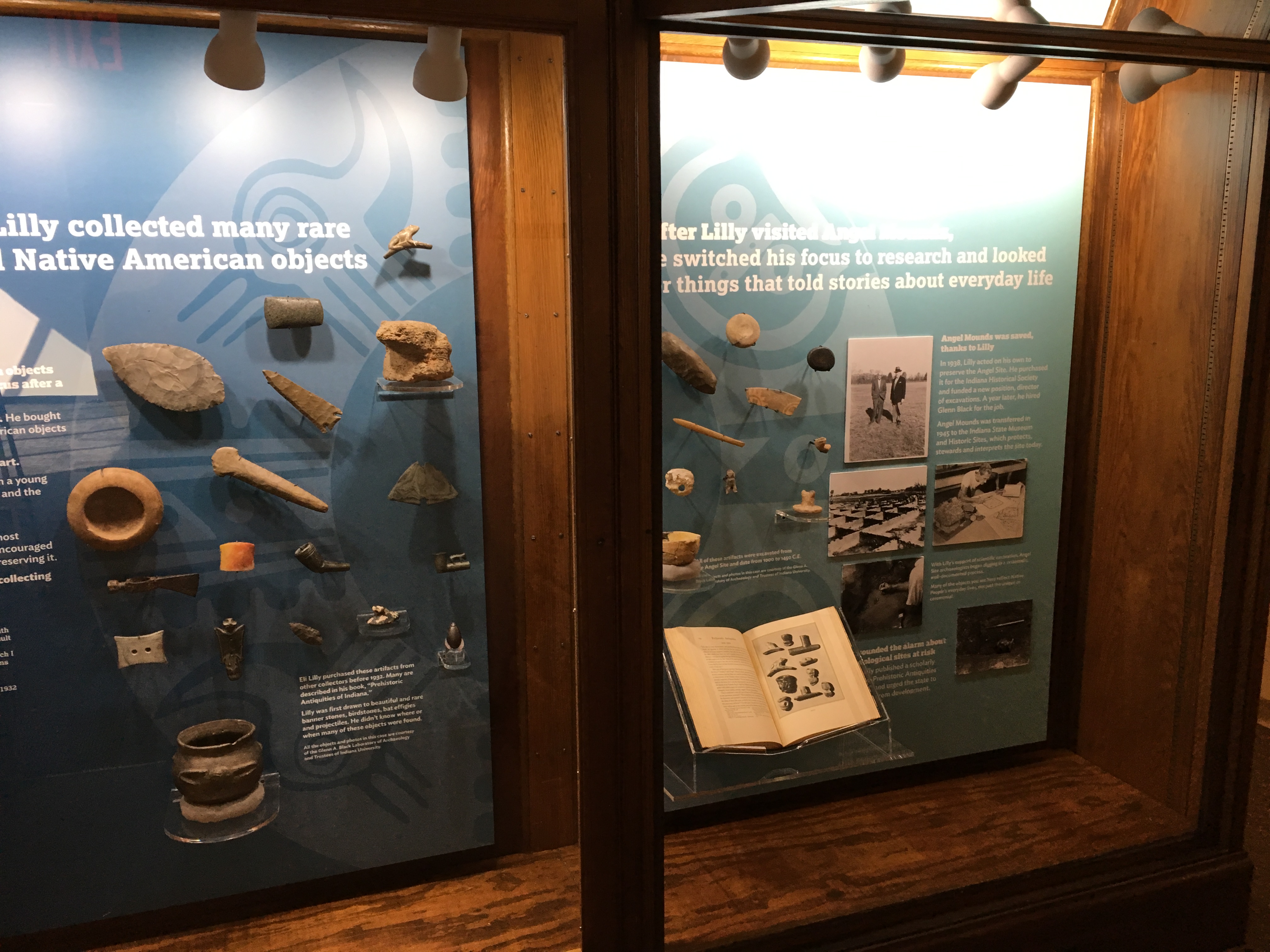
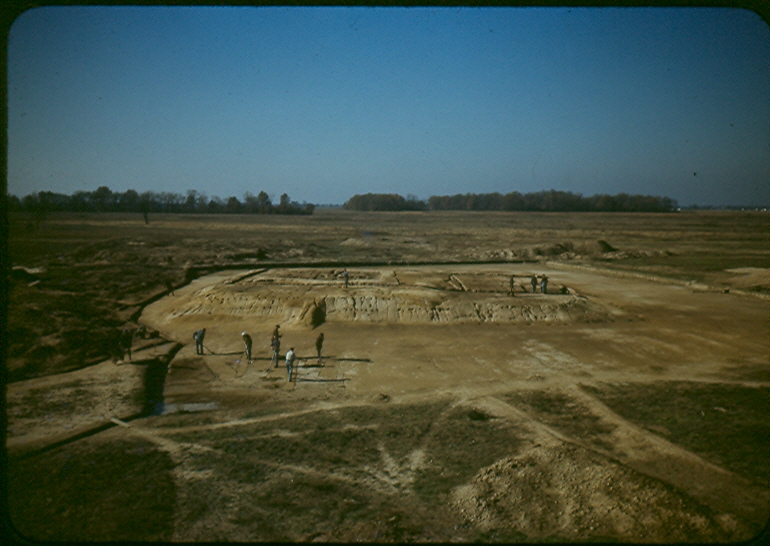
In 1938, the site was acquired by the Indiana Historical Society, and in 1939 A Works Progress Administration project was awarded to the site to carry out archaeological investigations of the property. Under the direction of Glenn A. Black, and with the support of Eli Lilly, pharmaceutical giant in Indianapolis, 277 men began work on the site in April of 1939. Their work would continue till May of 1942 when the United States entered WWII.
In 1946, Indiana University took over the excavations, again under the direction of Glenn Black, and Angel Site would become the official field school location for the university. That same year ownership of the site was transferred to the State of Indiana, with Indiana University retaining the excavation rights.
Today Angel Mounds State Historic Site is part of the Indiana State Museum and Historic Sites, an agency of the State of Indiana. The site contains a museum and visitors center that details the work done by archaeologists and what that tells us about the life ways of the people who lived there. A hiking trail guides you around the village site to highlights, with markers discussing certain points along the trail. A reconstructed WPA laboratory is also on the site where field school work is done and explained to the visitor when an active excavation is going on.
Knob Hill Tavern, Indiana 662, Newburgh, IN, USA
Distance: 1.91 mi (straight line)
Rivertown Trail, Rivertown Trail, Newburgh, IN, USA
Distance: 2.04 mi (straight line)
715 State Route 662, Newburgh, IN 47630, USA
Distance: 2.06 mi (straight line)
715 State Route 662 Newburgh, IN 47630
Distance: 2.06 mi (straight line)
Newburgh Farmers Market, Old Lock & Dam Park, Newburgh, IN, USA
Distance: 2.85 mi (straight line)
Festivals and Events Food and Drinks Shopping
View Listing
Oak Hill Cemetery and Arboretum, East Virginia Street, Evansville, IN, USA
Distance: 5.38 mi (straight line)
Children's Museum of Evansville, Southeast 5th Street, Evansville, IN, USA
Distance: 6.65 mi (straight line)
Museums and Interpretive Centers
View Listing
Reitz Home Museum, Chestnut Street, Evansville, IN, USA
Distance: 6.73 mi (straight line)
Museums and Interpretive Centers Guided Tours
View Listing
Evansville Museum, Southeast Riverside Drive, Evansville, IN, USA
Distance: 6.73 mi (straight line)
Museums and Interpretive Centers
View Listing
Willard Public Library, North First Avenue, Evansville, IN, USA
Distance: 7.04 mi (straight line)
USS LST-325, Northwest Riverside Drive, Evansville, IN, USA
Distance: 7.25 mi (straight line)
Museums and Interpretive Centers Guided Tours Forts
View Listing
John James Audubon State Park, Henderson, KY, USA
Distance: 7.40 mi (straight line)
Museums and Interpretive Centers Lodging Outdoor Experiences
View Listing
Atkinson Park, North Elm Street, Henderson, KY, USA
Distance: 9.08 mi (straight line)
Walks and Hikes Outdoor Experiences
View Listing
Mesker Park Zoo, Mesker Park Drive, Evansville, IN, USA
Distance: 9.12 mi (straight line)
Outdoor Experiences Guided Tours
View Listing
Bluegrass Music Hall of Fame & Museum, West 2nd Street, Owensboro, KY, USA
Distance: 21.86 mi (straight line)
Museums and Interpretive Centers Galleries and Venues
View Listing
Lincoln Pioneer Village and Museum, Fairground Drive, Rockport, IN, USA
Distance: 21.91 mi (straight line)
Museums and Interpretive Centers Guided Tours
View Listing
Fetta Specialty Pizza & Spirits, Saint Ann Street, Owensboro, KY, USA
Distance: 21.91 mi (straight line)
Smothers Park, West Veterans Boulevard, Owensboro, KY, USA
Distance: 21.92 mi (straight line)
Outdoor Experiences Viewpoints
View ListingOur bi-weekly newsletter provides news, history, and information for those interested in traveling along along the Lewis & Clark Trail.